Quick rant today, UK publishes the ENR obstacles as a XLS file so that’s better than a PDF
Update1: Just checked Italy AIP and it’s painful to see 210+4+60 pages of PDF with obstacle data! So clearly UK is doing better than Italy

But they don’t provide a column for latitude, longitude and elevation that is usable without processing which makes it not possible to consume just after download without doing some handling of the file that may introduce mistakes if not done carefully


After some fiddling here is how everything looks in QGIS which is my opensource GIS of choice


Conclusion
+1 For providing excel files for obstacles
-1 For not providing columns to be read directly by software
-2 For not providing AD obstacles and the ones in AD Obstacle files in a machine readable format
Overall although trying to do a right thing and working in the correct direction the information is not really that usable or complete in comparison with other States that provide just the PDF version.
Hopefully they will move fast towards providing data sets compliant with AIXM 5.1+ or at least add the columns in a way it can be loaded easily in any GIS software.
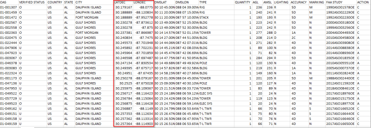
Update 2: Format from FAA DVOF
What are you doing in your country to provide the obstacle data that everyone needs but nobody really wants in PDF or charts?


1 Comment
Malintha Rajasekara · October 11, 2019 at 6:34 am
That’s a great artical about rhe ETOD.
Love that…